

Introduction to the Firth of Clyde
The Firth of Clyde is one of Scotland’s most historically rich and geographically fascinating coastal regions. When people search for a “map Firth of Clyde,” they are often looking for more than just a simple geographic outline—they want context, landmarks, travel routes, islands, and an understanding of how this vast body of water connects communities, culture, and commerce. Located on the west coast of Scotland, the Firth of Clyde stretches deep into the mainland, creating a natural harbor that has supported trade, tourism, and maritime traditions for centuries.
Understanding the map of the Firth of Clyde allows you to visualize how the region functions as a network rather than a single destination. From bustling port towns to peaceful islands, every point on the map tells a story. The waterway acts almost like a highway, connecting Glasgow to the Atlantic Ocean while threading together historic settlements such as Greenock, Largs, Rothesay, and Campbeltown.
What makes this region especially compelling is how geography has shaped life here. The fjord-like sea lochs carve into the mainland, creating protected waters that once supported one of the world’s greatest shipbuilding industries. Today, those same waters attract sailors, wildlife enthusiasts, and travelers seeking scenic coastal routes. A map is not just a navigation tool here—it is a guide to understanding Scotland’s maritime soul.
Geographic Overview of the Firth of Clyde
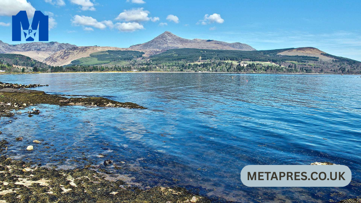
At its core, the Firth of Clyde is a large inlet of the Atlantic Ocean. It begins near the Mull of Kintyre and extends northeast toward Glasgow, gradually narrowing into the River Clyde. On a map, you’ll notice how the firth widens dramatically before branching into several sea lochs, including Loch Long, Loch Goil, and Gare Loch. These natural extensions create an intricate coastal pattern that feels almost maze-like when viewed from above.
The geography is defined by contrasts. Wide open waters sit beside sheltered bays, while mountainous backdrops frame peaceful shorelines. This variation has practical implications as well—sheltered areas made ideal docking locations for ships, while deeper channels allowed large vessels to travel inland. Even today, commercial and passenger ships rely on these routes.
Another interesting feature visible on any detailed map is the division between the Inner Clyde and the Outer Clyde. The Inner Clyde is closer to Glasgow and historically more industrial, whereas the Outer Clyde opens toward the Atlantic and features rugged coastlines and island clusters. Together, these zones illustrate how the firth transitions from urban to wild in a surprisingly short distance.
Historical Importance Reflected on the Map
If you overlay historical data onto a modern map of the Firth of Clyde, you’ll quickly see why this region played such a major role in Britain’s maritime history. During the 19th and early 20th centuries, the River Clyde became synonymous with shipbuilding. Towns along the firth grew rapidly as shipyards expanded, drawing workers and engineers from across the country.
Ports such as Greenock and Port Glasgow appear prominently on maps for good reason—they were gateways to global trade. Ships built here traveled worldwide, transporting goods and passengers during an era when sea travel was the backbone of international connection. The geography made it possible: deep waters, protected harbors, and easy access to the Atlantic.
Even wartime strategy relied heavily on this region. Naval bases were established in sheltered sea lochs, hidden from open-ocean threats yet close enough for rapid deployment. When you study a historical map, you begin to see the firth not just as a body of water but as a strategic asset that influenced military planning, economic development, and technological progress.
Major Towns and Cities Along the Firth

A map of the Firth of Clyde highlights several towns that each bring their own personality to the coastline. Glasgow sits at the northeastern edge, technically on the River Clyde but deeply connected to the firth’s maritime culture. Though now known more for arts and education than shipbuilding, its waterfront legacy still shapes the city’s identity.
Moving westward, Greenock stands out as a major port town. Its position on the southern bank made it a natural docking point for transatlantic vessels. Today, cruise ships frequently stop here, bringing visitors eager to explore Scotland’s western landscapes.
Largs, on the opposite shore, offers a more relaxed coastal atmosphere. Known for its seaside charm, it acts as a departure point for ferries heading to nearby islands. Meanwhile, further south, towns like Ayr and Troon combine beach scenery with golfing prestige, showing how the firth supports both recreation and commerce.
Each settlement contributes to the larger story. When you examine the map closely, you see how distances between towns are relatively short, reinforcing the sense of interconnected coastal life that defines the region.
Islands That Shape the Firth’s Identity
One of the most striking elements of any Firth of Clyde map is the cluster of islands scattered across its waters. These islands are not just geographic features—they are cultural landmarks that attract travelers year-round.
The Isle of Arran is often called “Scotland in miniature” because it contains mountains, forests, and coastal scenery within a relatively small area. Its position in the firth makes it highly accessible, yet it still feels remote enough to offer a genuine escape from urban life.
The Isle of Bute, located closer to the mainland, has long been a favorite holiday destination. Victorian tourists once flocked here for seaside vacations, and its elegant architecture still reflects that golden era of travel.
Further out, Great Cumbrae and Little Cumbrae sit near Largs, providing excellent opportunities for cycling and wildlife watching. When you look at the map, these islands appear strategically placed, almost forming stepping stones across the water. Their presence breaks up the expanse of sea and creates natural sailing routes that have been used for generations.
Understanding Sea Lochs on the Map
Sea lochs are one of the defining geographic features of the Firth of Clyde. Unlike freshwater lakes, these are arms of the sea that stretch inland, often surrounded by steep hills. On a map, they appear as long, narrow inlets branching off from the main firth.
Loch Long is among the most prominent. Its depth allows large naval vessels to anchor safely, which explains its historical military importance. Gare Loch, another key inlet, is known for its calm waters and scenic surroundings.
Loch Goil offers a quieter alternative, favored by sailors seeking less crowded routes. The protective geography of these lochs reduces wave action, making them ideal for boating and watersports.
Together, these inlets create a layered coastline that feels almost sculpted by nature. Studying them on a map helps you appreciate how the firth is not a single open space but rather a network of sheltered corridors leading deep into Scotland’s landscape.
Navigation and Maritime Routes
Navigation in the Firth of Clyde has always required careful planning, and modern maps reflect centuries of maritime knowledge. Shipping lanes are clearly defined to guide vessels safely through deeper channels while avoiding shallower waters.
Ferries form another essential component of these routes. Regular crossings connect mainland towns with islands, ensuring that even remote communities remain accessible. For travelers, these ferry lines often double as scenic journeys, offering panoramic views of the surrounding hills and coastline.
Sailing enthusiasts are particularly drawn to the region because of its predictable tides and well-marked passages. Marinas dot the shoreline, providing docking points that encourage longer voyages across the firth.
What becomes evident when studying these routes is how the firth functions as a living transportation system. It is not merely a picturesque body of water—it is an active corridor supporting travel, logistics, and recreation.
Wildlife and Natural Landscapes Visible Across the Region
A detailed map of the Firth of Clyde often marks protected areas and nature reserves, hinting at the biodiversity thriving beneath and above the water. Dolphins and porpoises are frequently spotted here, particularly in deeper channels where fish populations are strong.
Birdlife is equally impressive. Coastal cliffs and island habitats support species ranging from gannets to puffins. For birdwatchers, the map becomes a treasure guide pointing toward prime observation spots.
The surrounding landscapes add another dimension. Rolling hills transition into dramatic highlands, while beaches provide softer contrasts to rocky shores. Seasonal changes transform the scenery—from vibrant greens in summer to misty grays that create an almost cinematic atmosphere.
These natural elements remind us that the firth is not just about human history. It is a thriving ecosystem where land and sea interact continuously, shaping habitats that have endured for centuries.
Tourism and Travel Planning Using the Map
For travelers, a Firth of Clyde map is more than orientation—it is the foundation of itinerary planning. Whether you prefer road trips, ferry hopping, or sailing adventures, the map reveals countless possibilities.
Many visitors begin in Glasgow before heading toward coastal towns. From there, ferry routes open doors to island exploration. Arran, for example, can easily fill several days with hiking trails, castles, and distillery visits.
Cyclists often gravitate toward Great Cumbrae because of its circular coastal road. Meanwhile, golfers may focus on Ayrshire, home to some of the world’s most celebrated courses.
The beauty of planning with a map is that you can tailor your experience. Some choose fast-paced travel covering multiple destinations, while others settle into a single seaside town for a slower, more reflective getaway.
Economic Role of the Firth Today
Although shipbuilding has declined from its historic peak, the Firth of Clyde remains economically significant. Ports still handle cargo, and tourism generates substantial revenue for coastal communities.
Renewable energy projects are also beginning to influence the region. Offshore wind initiatives and marine research signal a shift toward sustainable industry, showing how the firth continues to evolve.
Fishing remains part of local tradition, though modern regulations aim to balance commerce with conservation. Meanwhile, cruise tourism has introduced new opportunities for hospitality businesses.
When you view these developments on a contemporary map, you see an economy adapting rather than fading. The firth’s strategic location ensures it will remain relevant for decades to come.
Cultural Heritage Along the Shoreline
Culture is woven deeply into the geography of the Firth of Clyde. Historic castles, Victorian promenades, and maritime museums line the coast, each reflecting a different chapter of Scottish history.
Festivals and sailing events bring communities together, celebrating traditions that date back generations. Even local cuisine tells a story—fresh seafood often takes center stage, reinforcing the connection between people and water.
Artists and writers have long drawn inspiration from these landscapes. There is something undeniably poetic about the shifting light over the firth, and many creative works attempt to capture that atmosphere.
Exploring cultural sites with a map allows you to connect physical locations with the narratives behind them. It transforms sightseeing into a deeper, more meaningful experience.
Climate and Weather Patterns
Weather plays a powerful role in shaping life around the Firth of Clyde. Influenced by the Atlantic, the region experiences relatively mild winters compared to other parts of Scotland. Summers are comfortable rather than extreme, making outdoor exploration enjoyable.
Rain is common, but it contributes to the lush greenery that defines the landscape. Misty mornings often give way to surprisingly bright afternoons, creating dynamic views that photographers love.
Wind conditions can shift quickly, which is why maritime navigation relies heavily on updated charts and forecasts. For travelers, packing layers is always wise—sunshine and drizzle can occur within the same day.
Understanding these patterns through a geographic lens helps explain why settlements developed where they did, often in sheltered areas offering protection from harsher conditions.
Modern Mapping Technology and Exploration
Digital mapping has revolutionized how people interact with the Firth of Clyde. Satellite imagery provides breathtaking perspectives, revealing underwater contours and coastline details once known only to experienced sailors.
Interactive maps allow users to plan routes, locate marinas, and even identify wildlife hotspots. Hikers benefit as well, with trail maps connecting coastal paths to inland routes.
Drone photography has added yet another dimension, capturing sweeping visuals that highlight the firth’s scale. These technologies make the region more accessible while deepening appreciation for its complexity.
Despite these advances, traditional paper charts still hold value, particularly among seasoned mariners who trust their reliability.
Why the Firth of Clyde Map Matters More Than Ever
In an age where travel is increasingly experience-driven, understanding geography enhances every journey. A map of the Firth of Clyde does more than show direction—it reveals relationships between land, water, and community.
It helps travelers move with confidence, historians trace developments, and environmentalists monitor ecosystems. Even locals continue discovering new corners of the region simply by studying its layout.
Perhaps most importantly, the map reminds us that this is a living landscape. Industries may change, tourism may grow, and technology may evolve, but the fundamental geography remains a constant thread linking past, present, and future.
For anyone curious about Scotland’s west coast, learning to read this map is the first step toward truly understanding the region.
FAQs
What is the Firth of Clyde known for?
It is famous for its maritime history, scenic islands, and role in Scottish shipbuilding.
Where is the Firth of Clyde located?
It lies on the west coast of Scotland, opening into the Atlantic Ocean.
Which islands are most popular in the Firth of Clyde?
Arran, Bute, and Great Cumbrae are among the most visited.
Can you travel between towns using ferries?
Yes, ferries regularly connect mainland ports with nearby islands.
Is the Firth of Clyde good for sailing?
Its sheltered waters and marked routes make it a top sailing destination.
What wildlife can be seen there?
Dolphins, porpoises, seabirds, and diverse marine life are common.
When is the best time to visit?
Late spring through early autumn typically offers the most pleasant weather.
Why is the map important for travelers?
It helps plan routes, identify attractions, and understand regional geography.
Was the area important historically?
Yes, it was a global center for shipbuilding and trade.
Is the region still economically active?
Tourism, shipping, and renewable energy continue to support the local economy.
Also read: Blue Eyed Plecostomus: The Complete Expert Guide to This Rare and Fascinating Aquarium Fish